 Our downtown loop crosses the historic Sixth Street Bridge for a beautiful view of downtown Grand Rapids along the river. We’ll run past the convention center, the Amway Grand Plaza and within only a couple hundred yards of the final resting place of Gerald R. Ford. After our brief downtown tour, we’ll head out of town toward Millennium Park for a West Michigan color tour. In Millennium Park, we’ll take advantage of some of the newly built paved paths, through the “Enchanted Forest” and between some beautiful lakes. You’ll love the run through Millennium Park. We'll run across the river for an out and back piece on Indian Mounds Road where you'll get to see all of your friends who are either ahead of or behind you.
Relay Exchange Points
- Mile 4.0
- Mile 10.4
- Mile 14.9
- Mile 21.5
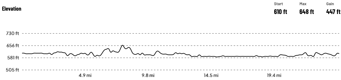
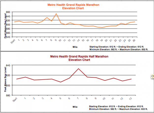
Elevation map